Conservation Sea Change: A UCSB Biologist and Colleagues Demonstrate How Satellite Data on Fishing Can Help Protect Ocean Biodiversity
March 10, 2016
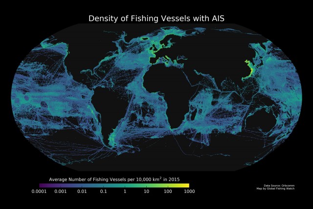
A map of average vessel density in 2015 created using AIS data. Credit: Global Fishing Watch
Beyond the breakers, the ocean is like the Wild West. While not completely lawless, its vastness and remoteness make it hard to observe and more difficult to manage human activity.
Recently developed technology may change that. A navigational safety aid called AIS (Automatic Ship Identification Systems) — which transmits publically accessible data on the exact position of ocean-going vessels via satellite — is not only useful for collision avoidance, but also has potential as a means of protecting ocean health. An international group of scientists explored exactly how the power of this information could be harnessed to intelligently manage sustainable futures for fish and fishermen across global oceans.
Related Links